

Studio (3rd year, 2019)
- Do reclaimed lands dream of re-emerging lagoons?
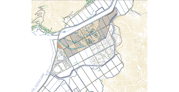
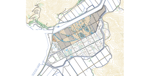
- There used to be a lagoon in this area, but land reclamation was conducted from the late 1960s to the early 1970s, and it became a land. The original purpose of the reclamation had been to create paddy fields, but that purpose was lost in the middle of the project. Since the reclamation project was completed, the land has been variously transformed, such as by raising the land for converting to fields, constructing greenhouses, parks, seedling facilities, and receiving surplus soil on the land.
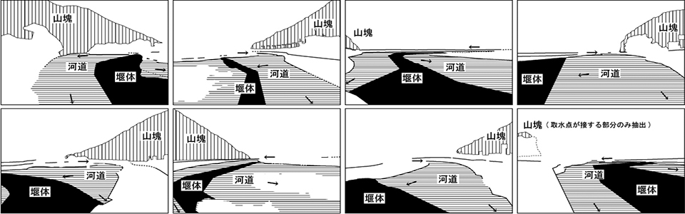
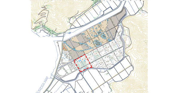
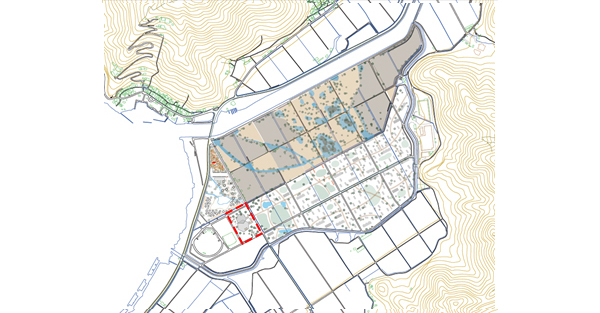
This land is bordered by a lake in the west, mountains in the east, mountains and rivers in the north, and farmlands and settlements in the south, and has a rich and open landscape. This land, which is located in the lakeside district, has the potential for coastal eco-tone restoration.
As a virtual project, we designed a specific scenario for spatial reorganization of this land, assuming disasters and social changes that might occur in the next 30 years.
- Assumed social situation:
With the advancement of IoT and AI technologies, lifestyles will change, and many things will be completed at home. Therefore, places where people can come out and interact with others and nature, will be demanded more and more.
Assumed disasters:
In 2030, heavy rain once every 200 years will cause flood damage to the area.
In 2040, the Nankai megathrust earthquake will occur and accept evacuees from outside the area.
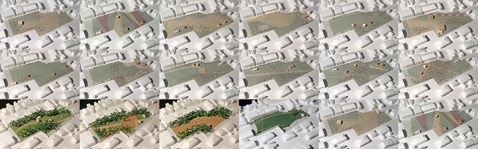
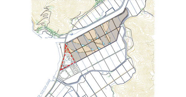
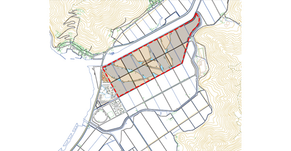
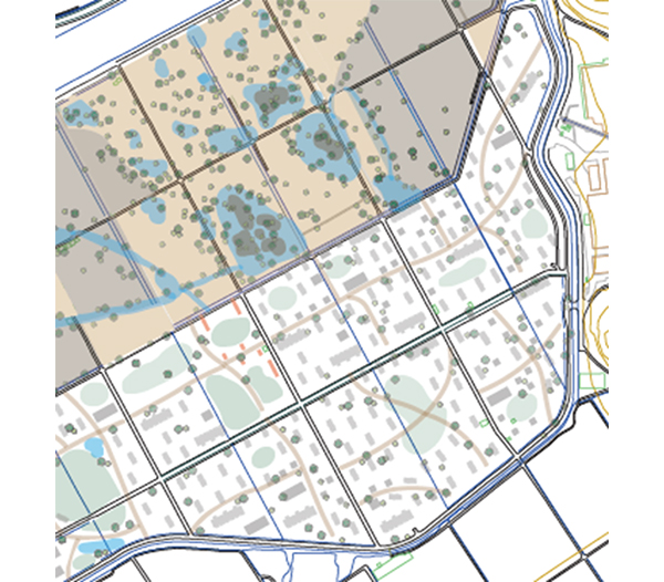
- 2020-2025
Landowner group invites a company for utilizing the land. The company will set up and operate a campsite in part of the existing sports park and north of it (dashed line in the figure below). The campsite will be the base of the lake excursion route and the place where visitors can enjoy the views of both lake and mountain, harvesting vegetables, fishing and exercise. It has tent sites, athletic fields, campfire squares, and BBQ houses, and pedestrian decks connect them.
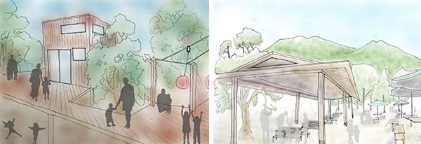
Cottages, athletic fields, pedestrian decks (left) , BBQ houses (right)
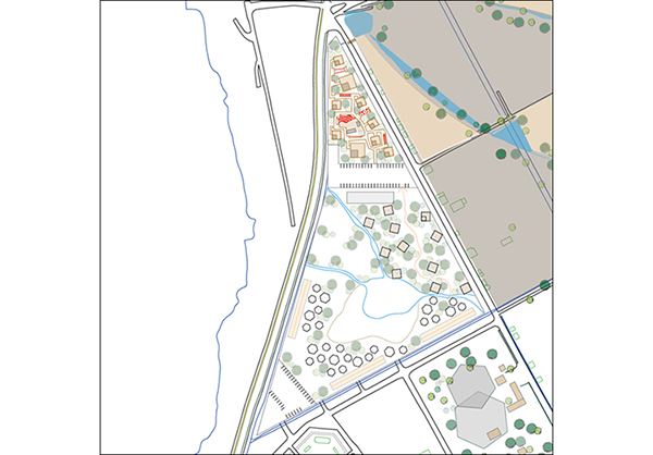
In the next phase, the company operating the campsite will convert the land on the north side to farms and rental farms. Part of the profits earned on those farms will be returned to the landowners. Vegetables from the farms will be used in the BBQ houses. In the rental farms, the borrowers will freely grow their favorite vegetables whenever they want. Farms and rental farms will be managed by the retired persons hired by the company. The experts invited to an agricultural school converted from the original seedling facility will provide technical guidances at the farms as well as the rental farms.
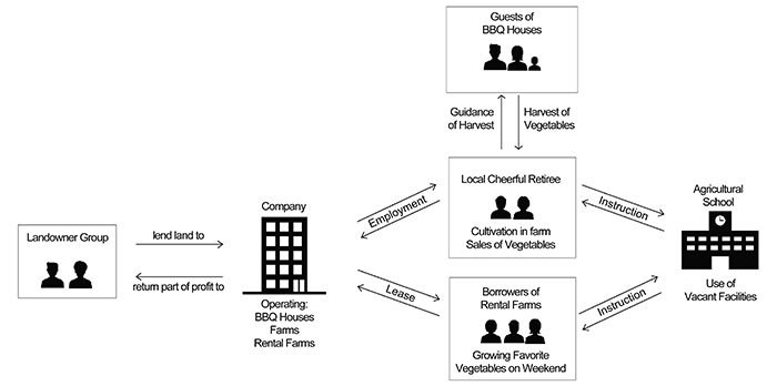
Farm and rental farm management system
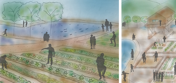
Farms and creeks(left), Stilt cottage(right)
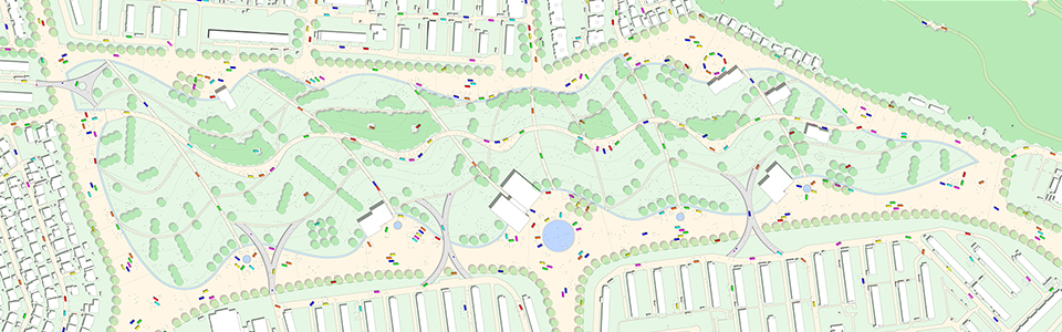
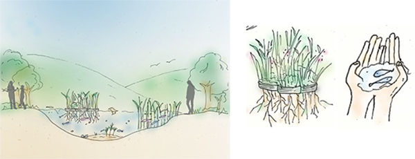
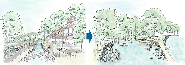
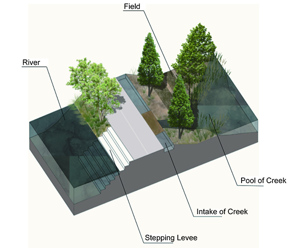
The company will create creeks with the farms and the rental farms. The creeks will be arranged so that they will flow slowly from the multiple intakes along the north river to the central main drainage channel, following the height difference of the land. Under the supervision of local museum curators, the creeks will be shaped to inhabit the lake's native aquatic life. In order to become research and exhibition facilities for coastal ecosystems, piers will be set up to bring visitors closer to the water surface, and riparian forests will be formed along the creeks.
The numerical values are the relative heights of the ground to the lake's standard water level.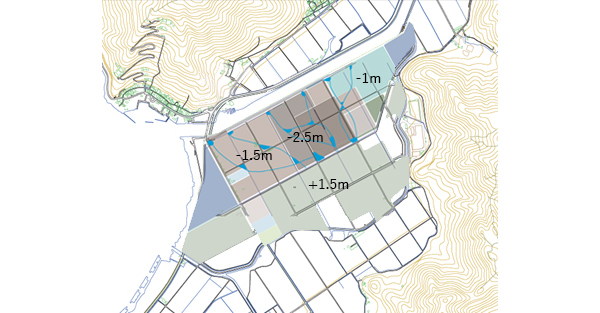
Outdoor exhibition(left), Creating a floating island with waste tires(center), Catching fish(right)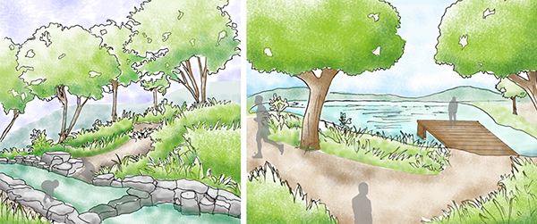
Creek and surroundings
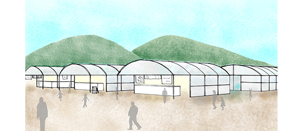
Unused greenhouses on the east side of the sports park will be reused as new sports facilities. The facilities will respond to the social needs of anyone who wants to enjoy sports casually regardless of age or disability.
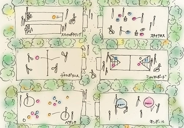
New sports facilities
- 2025-2030
The company will create a roadside station in the sports park. It will include restaurants, cafes, public baths, shops, direct sales outlets, and a observatory. A calm forest will be created around the observatory. A large open space will be created where the local fire festival, designated as a national cultural property, and morning markets will be held. It will also function as temporary shelters or places of stay for evacuees in any cases of disaster.
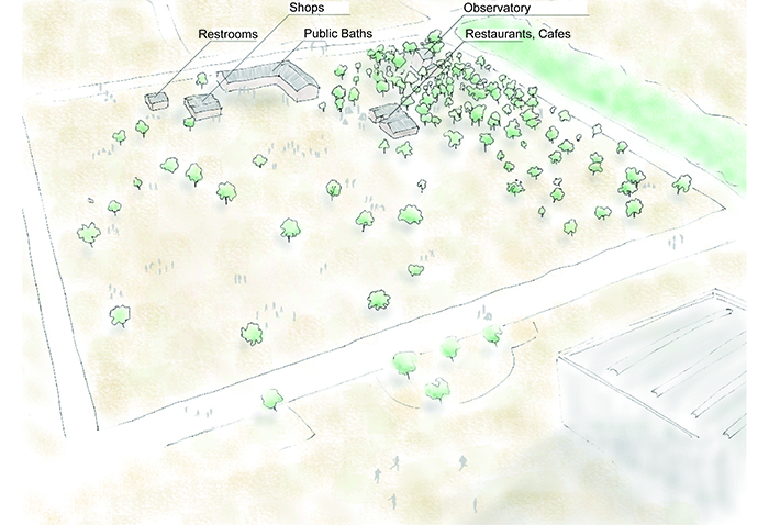
Roadside station
The riparian forests formed along the creeks through the previous phase will be spread throughout the site. Plant species suitable for wetland and those of showing the transition of the four seasons will be selected. The levees along the north river will be converted into water-familiar stepping spaces. Reeds and aquatic plants will grow along the creeks. The north side of the land will become rich in habitat for birds and fish.
Restoration of coastal eco-system
- 2030
Heavy rain once every 200 years will cause flooding of 2 to 4 meters in the farm / rental farm area on the north side where the ground level is lower than the standard level of the lake. The inundation depth of the camp site will be less than 2m and the land on the south side will be less than 1m. It will return to the same operational situation as before by 2031.
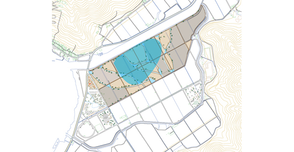
Area with inundation depth of 3 to 4m
- 2035-2040
The group of landowners, the company, and the local government will work together to develop spaces on the southern side with higher ground levels to accommodate the evacuees in preparation for a future disaster. It will accept 870 people from seven cities that have friendly city / disaster support agreements with the local government.
Creating spaces to accept evacuees
Houses and parks will be connected by gentle curved walkways, and benches will be placed at key points to encourage interaction among residents coming from various regions.
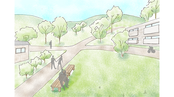
Apartments and detached houses will be mixed. Multiple types of residential units will be prepared to accommodate various lifestyles. Wooden or reinforced concrete houses will be provided so that evacuees will be able to continue to live here. Flexible layouts and universal designs will make the houses comfortable places to live, regardless of age or disability. In order to cope with severe cold in winter, the insulation and airtightness of the houses will be improved.
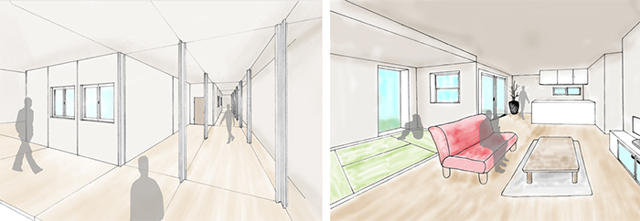
Interior of residential unit
- 2040
The Nankai megathrust earthquake will occur and accept 870 evacuees from 7 cities.
- 2045-2050
Some evacuees will become to settle.
On the west side of the residential area, vacant greenhouses will be converted into cafes and food stalls. The place will be located between the campsites, the farms, the sports park, the roadside station and the residential areas, and it will become the community space where people gather and interact.
Cafes and food stalls of greenhouses
- Finally
The land on the south side was raised after the reclamation project, and is less susceptible to flood damage. Therefore, unlike this scenario, even if a huge earthquake occurs earlier than the housing development, temporary housing will be created on the south side in anticipation of flood damage. In this way, the land will flexibly respond to disasters that may occur at any time, while dreaming of a reclaimed lagoon in the north lowland. - Instructor: Shuichi Murakami, Shinichi Todoroki, Shigeki Nishimura (TA)
Creator:Hikaru Asahi,Shun Adachi,Tomo Iguchi,Yuki Umezawa,Monari Kotsuji,Mika Nakano,Miho Nishimura,Eri Hashime
