japanese
Research on Kasumi levee
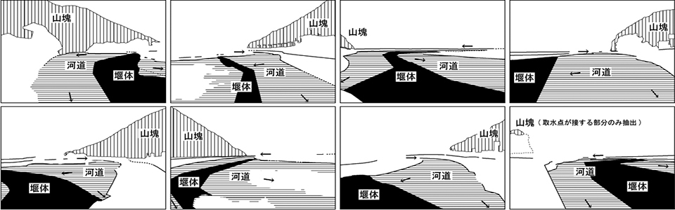
- Kasumi levee is an embankment that is broken in places and discontinuous.
Okuma, T.(1987) A Study on the Funcution and Etymology of Open Levee, Proceedings of 7th research meeting of Historical Studies in Civil Engineering, 257-266
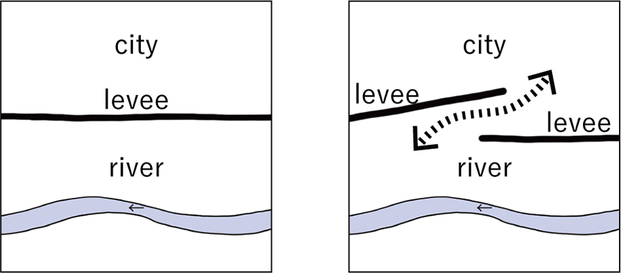
In the case of a continuous levee, as shown on the left, the city and the river are clearly separated. However, when the levee is discontinuous, as shown on the right, the city and the river are expected to be in close proximity through a gap in the levee.
Based on this hypothesis, this research is conducted to explore the nature of the relationship between the city and the river through the Kasumi levee.
-
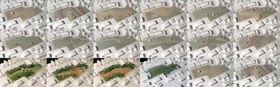
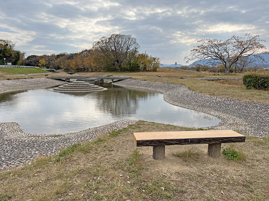
This photo was taken at the Doki River Waterfront School Park. The embankment can be seen on the left side of the image. On the other hand, another levee can be seen on the right side of the woods in the center of the image, and further on the right side, where there is a tall tree, there is no levee and shrubs in the river channel can be seen. Part of the park is located between the two lines of levees on the left and right.
-
more information
Murakami, S.(2022) Spatial characteristics of park green spaces located between two lines of discontinuous levees: a survey report on three cases of Kasumi levee in the Shigenobu River, Reports of the City Planning Institute of Japan, No.21-2, 102-106
Murakami, S.(2022) Will Kasumi levees create closer relationships between cities and rivers?: a survey report on three cases used as parks in the Doki Rive, Reports of the City Planning Institute of Japan, No.20, 405-408
Murakami, S.(2021) Land cover and land use of 296 Kasumi levees among 48 rivers in Japan: Focusing on their potentials to create closer relationships between cities and rivers, Reports of the City Planning Institute of Japan, No.20, 162-166
-
This research is underway as part of the Eco-DRR project of the Research Institute for Humanity and Nature.